FARNBOROUGH CHURCHYARD
The articles on this page were originally published in five parts in 1997 editions of the magazine of St. Giles church in Farnborough parish. The author was the late Peter Bailey, long term resident of Farnborough. He had many and diverse interests, and contributed greatly over many years to the well being of and record keeping for the parish.
The main article below tells how the churchyard in Farnborough developed from its inception some 800 years ago to the present day, The panel to the right discusses more generally how churchyards came into being, drawing on examples from across the land, demonstrating great diversity and idiosyncrasies.

St Giles Churchyard first came into being about 600 years ago when it was a very small area round the church. Over the years it has undergone a series of enlargements, first to the north and west and then to the south. The map above shows how this happened.
The first recorded burial is that of John Marshall on the 23rd. November 1538, This entry was made only a few weeks after the ‘Direction’ that Parish Registers of Baptisms, Marriages and Burials were to be kept. As the Parish was paying Tithes in the 12th. Century the church yard is at least as old as that but exactly what size and shape it was we have no idea.
In the Parish records we have a curious document as follows :- A list of the several Landlords and Occupiers of Land and Houses in the Parish of Farnborough in the County of Kent, relating to their several and respective marks belonging to the Fence in the Church Yard in the said Parish as follows:
Landlords
Tenants
No of Feet
The Rev. Mr
Thomas Brome
Peter Wynne
44
First next adjoining the
high road the left hand
of the Church gate.
Sir Thomas
Dyke
Thomas Stow
38
next Do.
Leonard
Bartholomew Esq.Stephen Bassett
16
Both houses next Do
each side of the gate
Richard
Staples
For his own
6
One fence beyond the
lower gate next the hole.
George Baldwyn
___________
6½ Next Do
Adgate
Broomfield Wm
Whiffin
6½ next Do
Widow Wahelyn
__________
6
next Do
Mry Elliott
John Jeale
4
Next Do- for the stept house
Margt. Brooks
otherwise Richard
6
Next Do
Widow Banking
Widow Dilley
10 next to
Widow Soane
Samuell Cooper
12 next Do
Michael Allen
Edwd Baldwyn
8
next Do
Wm Winne
For Mr Heaths
9 next Do
Martin Stow
Richard Best
7 Next Do, and Dilleys slip
Robert Diper
Thomas Wynn
12
Next Do
Mr Stears and
Widow Mitchell
10
for the House at
Broad St. Green next.
Mrs. Elliot
John Jeale
24 next Do
Mr Austin
Thomas Wright
16 next Do
Gandy Cooper
John Poole
20
next the stile and Pt
next the Field.
Mrs Elliot
John Rance
9
Next Do
Sr Thomas Dyke
Hen. Chapman
28 Next Do
Mr Cooper for
Chalk Barn & Whiffin
12
Next Do
Richard Mercer
____________
7 Next Do
Wm Winne
Wm Lemme
7
Next Do
Mr Floyer
Peter Wynne
33 Next Do
Edward Baldwyn
Richard Styles
4 Next Do
Thomas Chapman
Senr.
_6
Next Do
Mr Johnson
Edwd Whiffin
10 Next Do
Joseph Budden
|
Geo Dilley &
|
Wm Winne
|
Thom Chapman Junr|
6
Next Do for both Houses
Mr Allen
Geo Champion
12 Next Do
Wm Biggs
Geo Frances
7 Next Do
Mr Staples
Hen Chapman
12 Next Do
Peter Sykes
Thomas Lamb
12 Next Do
Gandy Cooper
Adgate Broomfield
12
Next Do
Jeremiah
Delver
Michl Mitchell
10 Next the right hand
post of the gate.
Taken this 14th day
of Feb. 1749
Henry Chapman, Thomas Wright -| Churchwardens
Peter Wynne,
Francis French, Thos. Lamb, John Poole, William Dilly, & John Jeale
present
The Church marks.
Using the figures in this document, if we measure up from the Lower Gate the 98ft. indicated we find that the ‘Church Gate’ (not called a Lych Gate) was some fifty feet nearer the church than the present one. If we continue to use these measurements, guided by the position of the grave stones pre 1749 & excluding those after 1854, when we know that the churchyard was enlarged, we establish a very small area round the church, but one which is in agreement with the figure quoted in the Tithe Assessment of 1840 of 1 Rood and 15 Square Poles ( 0.35 Acres).
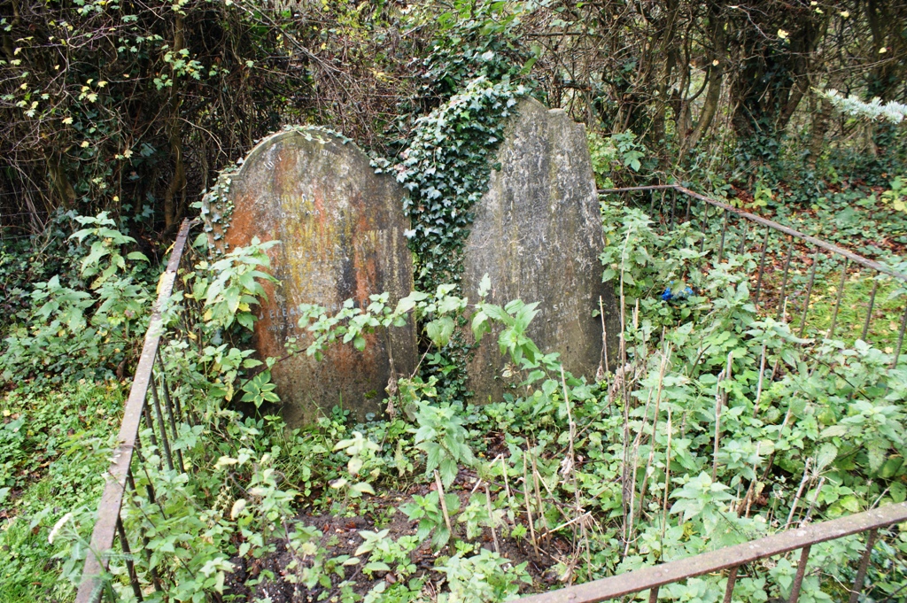
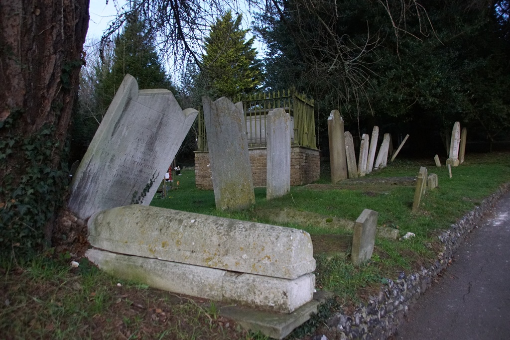 |
| Line of gravestones marking the boundary of the ancient graveyard |
This ‘God’s Third of an Acre’ served the parish from the beginning in the 12th Century or even earlier until 1854. The earliest tomb stones are usually hewn from the local stone and are quite simple, That of Frances and Richard Wynne, who died in 1776 & 1775 respectively, which is near the main path by the Choir Vestry is easily identifiable. It is a simple stone of Kentish Wragg, most likely from the Dunton Green area where the nearest quarries are found. It has a carved inscription but no ornamentation, and unfortunately it now has part of its top missing.
On the other side of the church is the stone of one of the Rance family who died in 1773. This stone is almost hidden by the brick table tomb just to the right of the main church door outside the Clergy Vestry window, here we find in addition to the deceased names, some quite elaborate carving, but still in the local stone.
These are not the oldest grave stones. To the right just as the path leads into the newer part of the churchyard and hard by the large ‘pine’ tree, is a stone which reads:- ‘Here lyeth the body of Thomas STOW who died 18 October 1723 in ye 60th year of his age, leaving 3 sons and 4 daughters, being the best of husbands and the best of fathers.’ This is a very typical Kentish grave monument consisting of a ‘body stone’ with a small foot stone and a large headstone carrying the inscription. We have a few of these ‘body’ stones’ but they are genuine stone and not caste in concrete as you often find, especially if they are much later Victorian copies.
When ‘Important’ people sort after much more elaborate monuments, the Table Tomb appeared. The tomb of ‘John Francis SKEGGS Esq.’, just behind the ‘Clergy Board’ and not far from the Lych gate, (it was just inside the churchyard when it was erected in the early 1850s), is quite typical, built from imported stone and carrying inscriptions in all four sides.
Usually these 19th century table tombs are surrounded by railings and we still have examples in the churchyard. On the other side of the church we have four other table tombs, all of which date from the same period but are of simpler design; those beneath the old yew tree are showing their age.
By 1850 the churchyard was becoming full, the option to start again on the far side would have necessitated removal of grave stones, so the ‘Parish’ prevailed on Mr. Skeggs to sell them land to the north and west of the existing churchyard. The original suggestion as recorded was that they hoped they could buy about ¼ of an acre, but in fact in 1854 the area added was nearer an acre, and the whole was fenced with a thorn hedge.
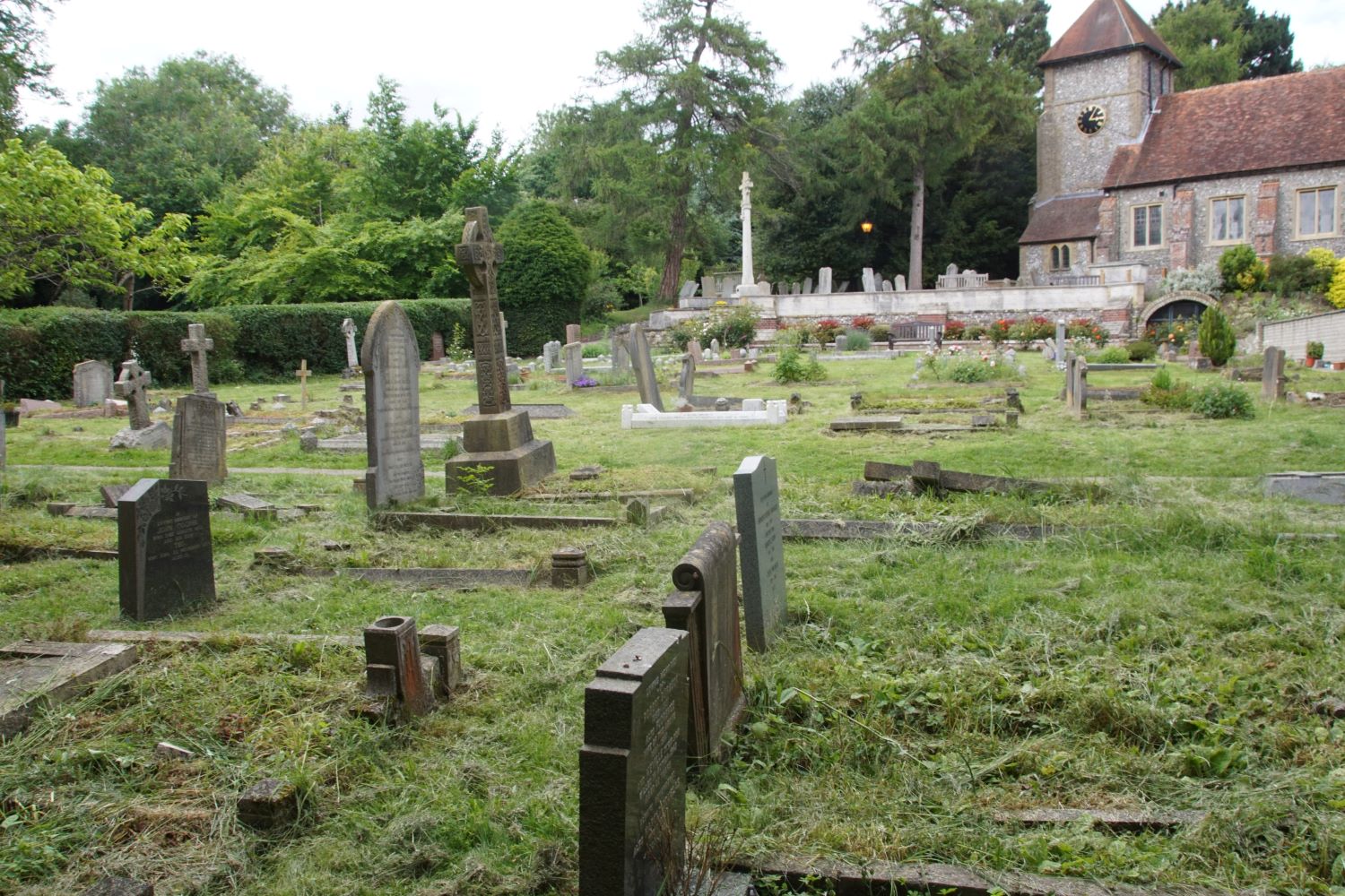
 |
 |
| gravestones in the 1850 extension | |
This area accommodated the parish until the end of the century and contains many new types of grave markers. The Celtic Cross made its appearance, and limestones and granites gave new habitats for different species of lichen. Some stones were painted and these can easily be picked out as the paint prevents the growth of algae and lichen, leaving us with a ‘white stone’ with black lettering.
Farnborough became a fully independent parish n 1876, and this led to a number of significant changes, 1885 saw the purchase of another section of land of 1 acre from Sir John Lubbock. This was to the south of the church, to include the ‘hole’, which was filled in 1909 with spoil from drainage work in the village. The opening of this new section at the beginning of the new century also saw a change in church record keeping. Since 1538 every one buried in the churchyard was recorded in the Burial Register, except for some omissions during 17th century when the ‘Commonwealth Government’ was in power and for some years there are no entries, neither is there any indication as to where they were buried. Grave stones with names are our only indicators before this date, and sadly many of these are known to have been lost.
 |
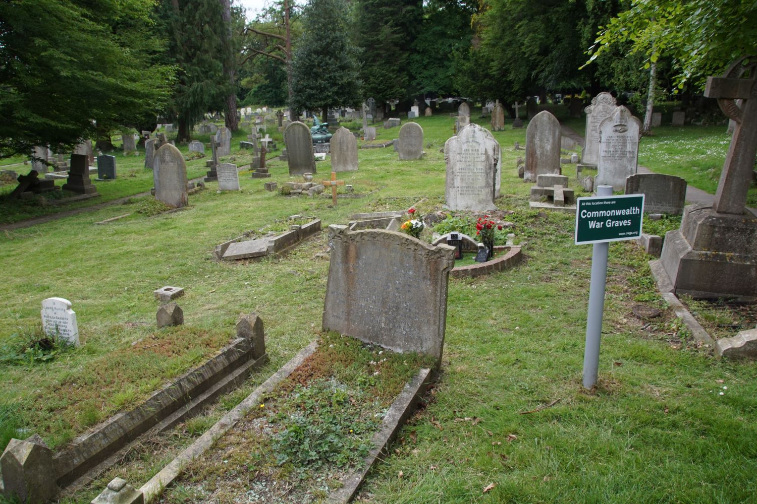 |
| gravestones in the 1885 extension, known today as part of the 'new graveyard' | |
In the new extension all future grave positions were mapped out, and spaces were numbered starting with No 1 at the South West corner of this new extension with wide pathways between graves, some sections being reserved for children’s graves A ‘Grave Register’ was introduced which for the first time recorded each grave space by number, who was buried there and when. Curbs all round the grave with corner cubes and perhaps a headstone became the normal grave monument from this time and each had to have its grave number engraved on it, as is in fact the regulation to this day, although mostly honoured in the breach.
By the 1920s the designated spaces were fairly well filled so some of the reserved child spaces were renumbered and the pathways were allocated as spaces. The numbering system just carryied on so that grave 412 ended up next to grave 1 and 537 next to 237. Finding graves in the churchyard was not always easy, even with the original maps, as these have been constantly altered as burials continued and graves were renumbered. This part of the churchyard does however contain some of our more spectacular monuments.
The ‘Lubbock Cross’, behind the Garden of Remembrance, is well worth examination. This depicts the interests of the family, has new as well as old stone age implements carved on it, a bee skep and a representation of the Avebury Ring, from which the family took its title. This monument started life in the churchyard, but when the vandalism against Lord Avebury’s grave began,(he had promoted the Bank Holiday bill in Parliament and employers have adopted these holidays for their workers, doing them out of their previous Saints Days holidays which were much more numerous) it was moved along with other Lubbock memorials into a private burial ground in the wood south of its present position. When this too was vandalised during the 1970s, this monument returned to the churchyard.
Read More
We have one ‘Architectural’ monument along the northern boundary of this section to the right at the end of the path. This is a triple plot, surrounded by curbs and having in the centre a miniature ‘Roman Temple’, with on one side a stone cross on a stepped plinth and on the other a more standard headstone, this is the grave of the Evans/Butterworth family.
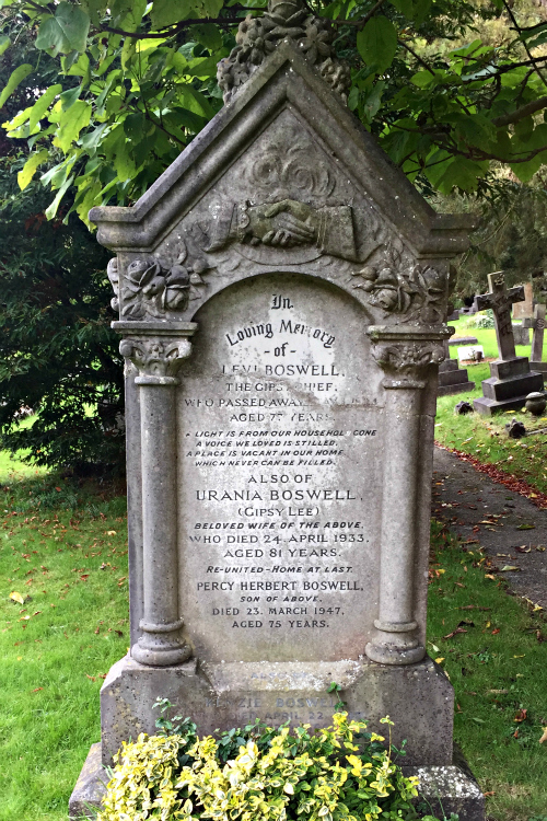
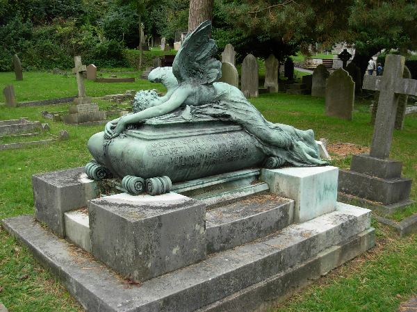
The grave of Gipsy Lee is well known and is easily found on the right hand side of the path half way between the church and the gate into Church Field. Near by is the monument with ‘The Fallen Angel’ bronze on top which is the grave of several members of the March family who were sculptors and painters and whose most famous production was the bronze figures for the National Canadian War Memorial in Ottawa (we have an ‘Epstine’ type bronze of theirs on the north wall of the nave inside the church).
 |
 |
For this new section a NEW Grave Register was opened, and the grave numbers again started at 1. The fence between the two sections was removed and the graves in the new and the old adjoined each other, one grave being 562 in the old register (Book 1) and 1 in the new register (Book 2). It can be very difficult to identify individual graves on the boarder line between the two areas especially as the much altered maps were drawn to different scales or in one case to no scale at all!
Shortly after this section of the churchyard started to be used, Diocesan Regulations began to appear restricting types of grave monuments that could be allowed in churchyards and this has greatly diminished the possible variation that we find from this age. Full curbs with often a ledger stone at the foot and a headstone became the extreme of flamboyancy and gradually this was reduced when the Diocesan Chancellor (he is the head ‘legal eagle’) prohibited curbs. These regulations were meant to produce an easy to keep churchyard, headstones with an integral flower vase holder in its base was all that was to be allowed. Cut flowers only, in the head stone holder were to be the only decoration so that the grass over the graves could be easily cut with no obstructions to the mower. The material of the grave stone was also specified so that it would last and not disintegrate with age as many of the stones in our churchyard have. Sculpture of the stone was restricted, as the crevices created in the stone tended to hold water and with the action of frost, pieces break off leaving a disfigured stone. This has resulted in very little opportunity for variation in the style of monuments since the 1950s.
A few years ago, the churchyard was in a very untidy state. A small voluntary group of people spend many hours putting it to rights so that today it is one of the best kept churchyards in the area, although it still requires the attentions of volunteers aided by our professional grass cutter to keep it so.
While we were doing this restoration, new maps of the churchyard were made, all the grave stones plotted and for the first time there is now a reliable index of where people are buried from 1880 (when the new graveyard was brought into use) to the present day.
Peter Bailey
The article above was written many years ago. Subsequently and in order to eliminate duplication of numbers, and thereby hopefully reduce confusion, graves in the original 1885 part of the 'new' graveyard had 1000 added to their grave number, while those in the 1935 extension had 2000 added. or 3000 in the case of the graves at the far end of the graveyard adjacent to the boundary hedge. A further area acquired in 1995 by extending the graveyard to the south has its graves numbered in the 4000 series.
Thus for the first time all graves in the churchyard have unique numbers.
Relatives wishing to locate a grave should contact Farnborough Parish Office in the first instance see https://farnborough-kent-parish.org.uk/index.html
FARNBOROUGH VILLAGE
About Churchyards
Churchyards, even in the middle of cities, are an oasis of peace and quiet which have existed in many cases for centuries past and witnessed many people seeking peace to sit and contemplate.The Celts who inhabited Europe for many centuries before the birth of Christ and were living in Britain when the Romans first came in 44 B.C. used the word CIRIC, pronounced 'CHIRCH' which gives us the English word 'Church'. The German word 'Kirche' and the Dutch word 'Kerk' are also recognisable to us as the name of the building where people assemble for Christian worship.
In Celtic times however, the word CIRIC meant 'Holy Ground', the place where the dead were buried; we had to wait until the late 10th. century for the Church with its yard round about it. The origin of the actual churchyard is obscure, but in England their inception is usually credited to Cuthbert, Archbishop of Canterbury, who in 752 got the approval of the Pope to set them up around city churches. This, following on from Pope Gregory's instruction to his missionaries in 601 that they were not to destroy pagan temples but to convert them to Christian Churches, explains why churchyards often pre‑date the church in origin being pre‑Christian sites taken over, or being continued in use by newly converted pagans of the area.
Of the churches on pre‑Christian sites the best known English examples are those at Knowlton in Dorset and Cholesbury in Buckinghamshire, both are within large circular earthworks, surrounded by banks and ditches.

The date of these Bronze Age earthworks at Knowlton, above, where the church is a ruin, is between 1800 and 500 B.C. and at Cholesbury, where the churchyard is still in use, the church stands on an Iron Age Hill Fort from about 500 B.C..
Early in his pontificate, Pope Gregory advocated churchyards round churches as he believed that the prayers for the dead were more likely to be answered if the living passed the graves on their way to church - at this time it was believed that souls remained in purgatory unless frequent masses were offered for them.
By the tenth century it was the practice to enclose one acre round the church as the burial ground ‑ God's Acre. Although the Romans favoured rectangular enclosures many of our church yards began as circular plots
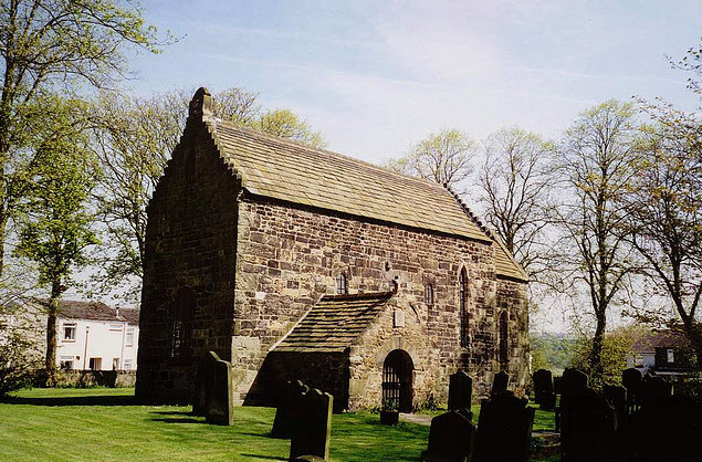
That at Escomb in County Durham, above, is still surrounded by its dry stone wall (with a road right round its outside) with its almost untouched Saxon Church at its centre. This one survives intact because an early 18th. Century Vicar did not like the ancient small church and decided to build a new Parish Church some distance away on top of a hill, the old church was just neglected and remains to this day an almost perfect specimen of what a church was like a thousand years ago.
As had always been the case, people paid only to be buried in the churchyard, the ownership of the ground remaining with the church, or more correctly vested in the Rector as his freehold, with each incumbent exercising his right during the tenure of the living. The practice was to start burying at one side of the churchyard and work across to the other side. When all the space of the churchyard had been used, burials began again at the original position.
Before the 18th. Century people were usually buried only in a winding sheet, (at one time this had to be certified to be made of wool when a government edict was in force to boost the wool trade), the ‘Parish Coffin’ only being used to carry the deceased from his home to church, stopping at the Lych to await the arrival of the Rector.
Lych Gates could be very simple structures or very elaborate. The name comes from the Saxon word ‘lic’ meaning corpse because the main function of the gate was to provide a covered place where the coffin could rest on a shelf and where the bearers could sit and wait for the incumbent. Most Lych Gates have been modernised over the years and changed into simple gateways to the churchyard.

At Anstey in Hertfordshire, above, a third of the Lych Gate is taken up by a small building, the local lock up, just big enough to hold one person. Some Lych Gates had cottages attached to them to provide lodging for the Parish Sexton.
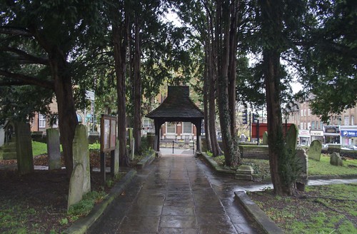
In the local area, Beckenham Parish Church has the oldest gate in this area, St. Nicholas, Chislehurst (below) has a Victorian Gate incorporating a coffin rest as part of the large centre pivoted main gate (usually kept locked).
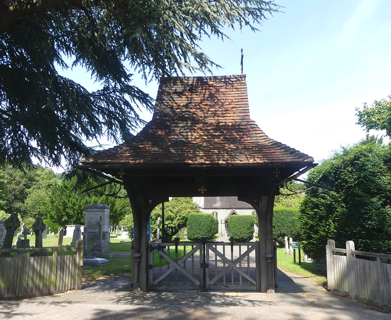
The main problem for Lych Gates is churchyard enlargement; where enlargement leaves the gate isolated and not in the churchyard fence it has either to be moved, abandoned or a new gate, usually of much simpler construction, built in its stead, as in Farnborough.
Up to the 17th. Century, individual tomb stones are quite rare, being usually reserved for the very well off and then usually sited inside the Church, even if the burial took place outside. Church-yards were unencumbered grass areas used for many purposes, people stopping to gossip after Church, as goes on today, but also for Church Fairs or grazing some of the parish sheep.
There are records of attempts by more than one incumbent trying to put a stop to the local cricket team using his churchyard as their match ground.
In the 17 Century the move of people to the towns due to the industrial revolution meant that people were paid in money rather than produce for their labour, and some at least wished to show their increased status by having markers to show where they had been buried. This meant that whereas the churchyard, which in many cases had been adequate for five hundred years or more, had either to be cleared of the existing grave stones or more land acquired.
If you go into a very old churchyard you will find that the ground level is much higher than the paths due to all the burials that have taken place in the past. Also you might find other buildings in the churchyard such as Charnel Houses, where the bones of the deceased were placed when an area of the church yard was reused, and often the church crypt was used for this purpose. ‘
Watching Houses’ still exist in some churchyards where paid men kept watch over recent burials in case ‘Resurrectionists’ tried to steal the body to sell to anatomists. The parish of Warblington in Hampshire, just east of Chichester, has two brick and flint examples at opposite corners of the churchyard, perhaps they were very prone to the ‘Resurrectionists’ activities.
In the churchyard at Great Chart near Ashford in Kent is a 16th. Century timber framed ‘Pest House’ where those people who contracted ‘Small Pox’ or ‘Plague’ were confined until they either got better or died. East Peckham, also in Kent, has stables in the churchyard for the horses of those attending church. Many churchyards have a well and various buildings to house people and domestic animals.
From the 17th. Century, if churchyards were unable to expand, especially in towns, the existing stones were either cleared to the edge of the yard or they were used to pave the church paths and the ground reused as before. Mainly most churchyards expanded and the various designs of tomb stones are characteristic of their age.
By late Victorian times, city churchyards had run out of space and this resulted in the establishment of the Public Cemetery, usually at some distance from the traditional churchyard. Here for the first time, people could own a grave space or even a family plot and erect much more elaborate monuments than allowable under churchyard regulations.
Peter Bailey