FARNBOROUGH VILLAGE
FARNBOROUGH, now in Greater London but formerly in Kent, should be distinguished from the better known Farnborough in Hampshire and from places of the same name in Berkshire and Warwickshire. It is a village on the high road to Sevenoaks, Tonbridge and Hastings, 14 miles from London, and about 350 feet above sea level.
 |
It lies on the northern slope of the North Downs, partly on
chalk and partly on the edge of the Thames basin.
Bones of the mammoth have been found in the flint pit on
Green-Street-Green, and palaeolithic flint implements are
plentifully scattered over the fields. A small piece of common is
known as Leach's Green from the family of the same name, still
resident, whose house adjoining the common was only pulled down when
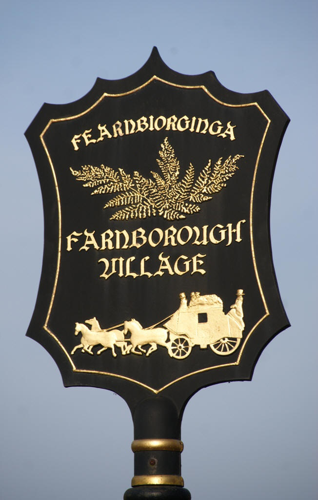
the present Board School was built. The name of the village derives from Feambiorginga or village among the ferns on the hill. Records date from 862AD when Ethelbert, King of Wessex gave away 950 acres at Farnborough. |
The village is not mentioned in the Doomsday Book although the manor existed in the middle ages, and in the 1200s was held by Simon de Montfort.
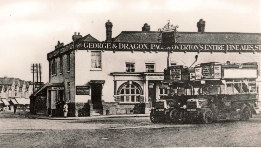
The section of the High Road between Bromley and Sevenoaks became a turnpike road in 1749. This was of considerable importance to the development of the village, which provided services and provisions to the coach operators and their passengers. This heritage is reflected in the village sign, see above. The central part of the village retains a shape and character that would be recognisable to a visitor from many centuries past. One reason for this is that the railway never came to Farnborough, although there were many proposals.
Ordnance Survey Maps
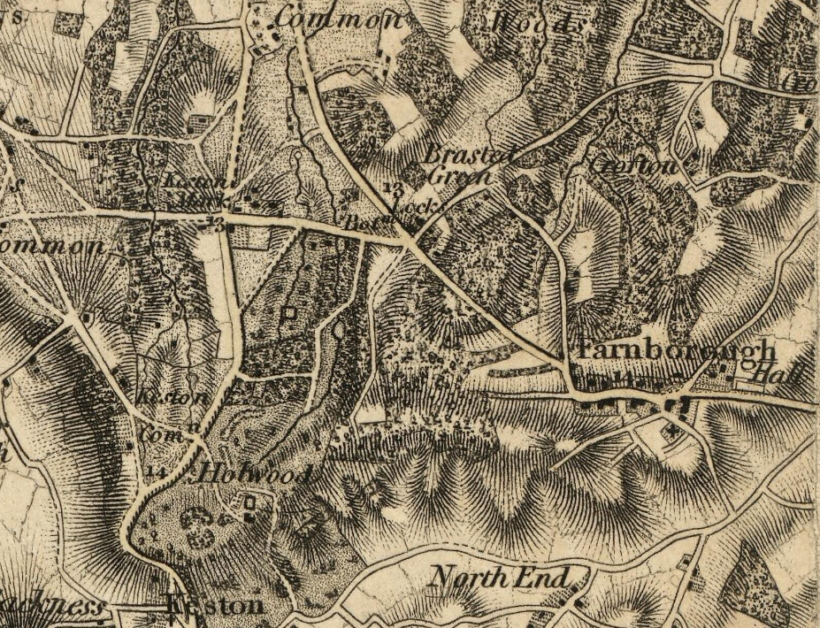
Here are extracts from Ordnance Survey maps from 1809 through to 1950. They are copyright Ordnance Survey, and are downloads from the National Library of Scotland website Click on images to enlarge.| One Inch to the mile, surveyed c 1805 published 1809 | |
 |
|
| As shown in this first map, the village at this time
consisted of clusters of buildings: the core of the village
surrounding the old George and Dragon; a few buildings at
the centre of the High Street; and the rows of houses at the
west end following on from the old Coach and Horses public
house.. Most of the rest of the area shown is open
farmland, and Farnborough Hall stands in isolation
within its own estate. St. Giles churchyard consisted
of only the ancient area immediately adjacent to the church. |
|
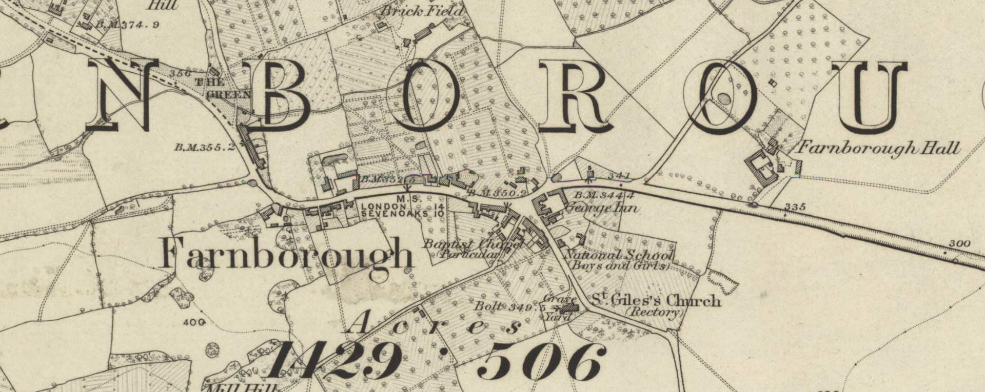
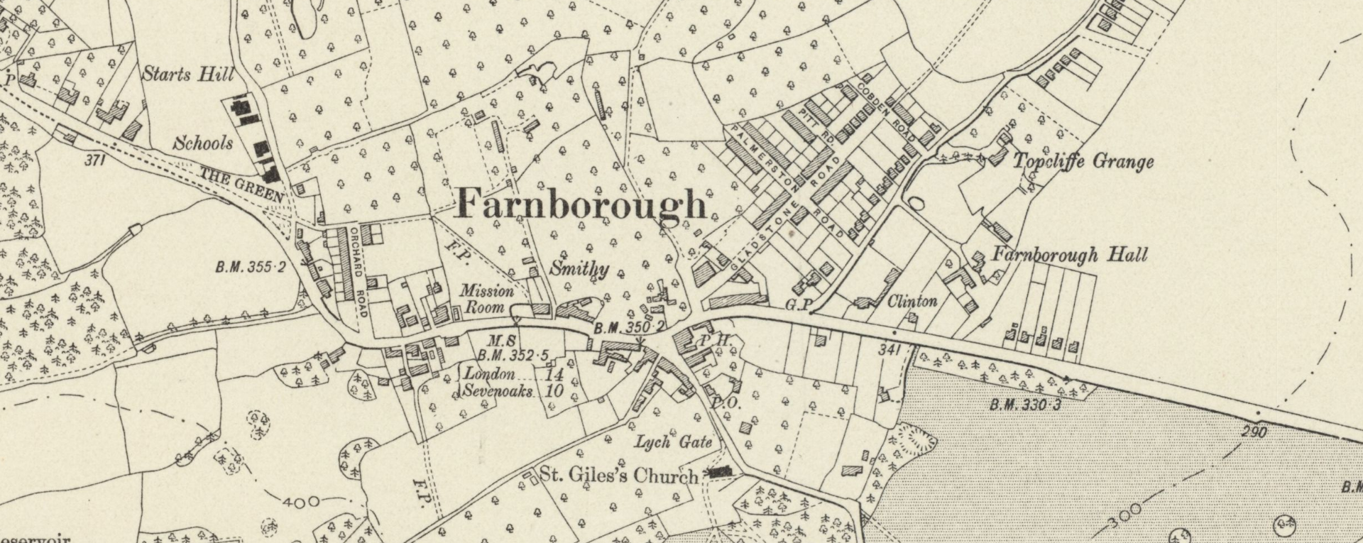
| Six Inches to a mile, surveyed 1862-1868, published 1870 | |
 |
|
| Seventy years later there has not been very much
development, but the larger six inch mapping scale allows
far more detail to be included. |
|
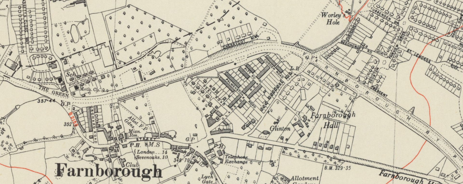
| Six Inches to a mile, revised 1908, published 1910 | |
 |
|
| In this revised map, the estate of housing along
Tubbenden Lane centred on Gladstone Road has now been built,
as has the row of housing in the new Orchard Road at the
western end of the Village. North of there the village
school is now in existence, and some more houses have been
built on the margins of the land associated with
Farnborough Hall. St. Giles churchyard has been extended. |
|
| Six Inches to a mile, revised 1948, published 1950 | |
 |
|
| The biggest addition here is Farnborough bypass, which
is shown passing through the centre of this map, beyond the
ends of the new residential roads shown in the previous map.
The 'Davis' estate is shown partiallly complete, as is the
new estate to the west of Starts Hill Road. Farnborough
Hall has lost more of its land, and the telephone exchange
has now appeared. |
|
|
|
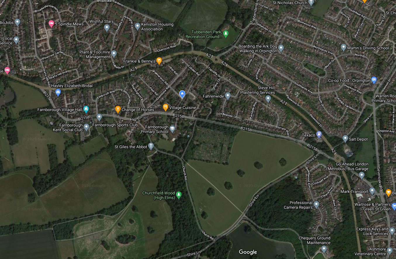 |
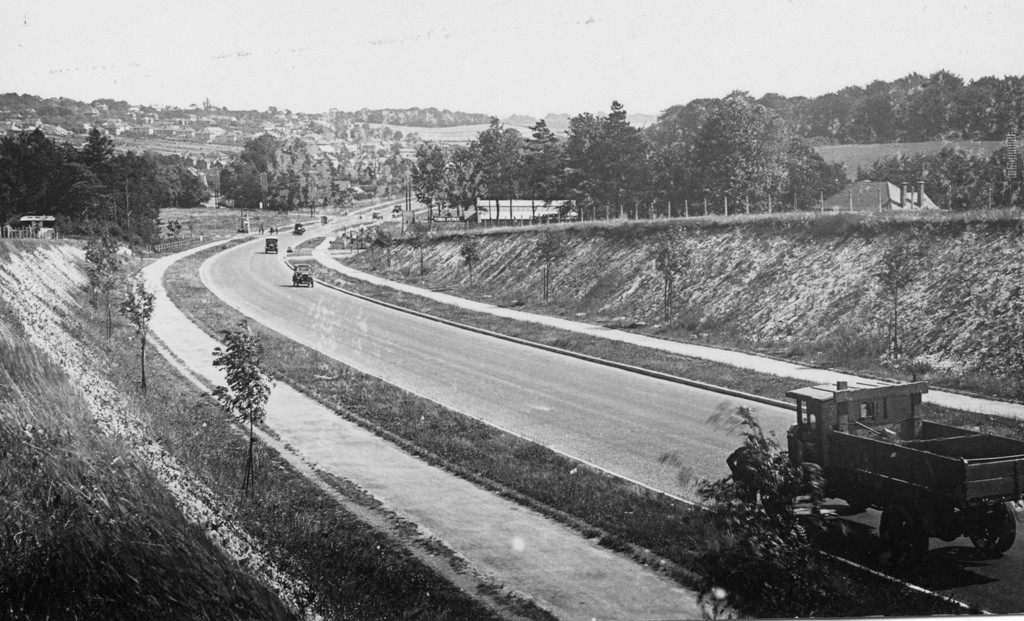
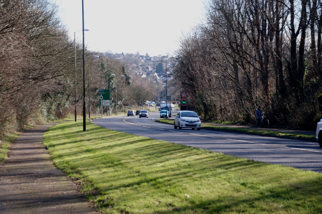
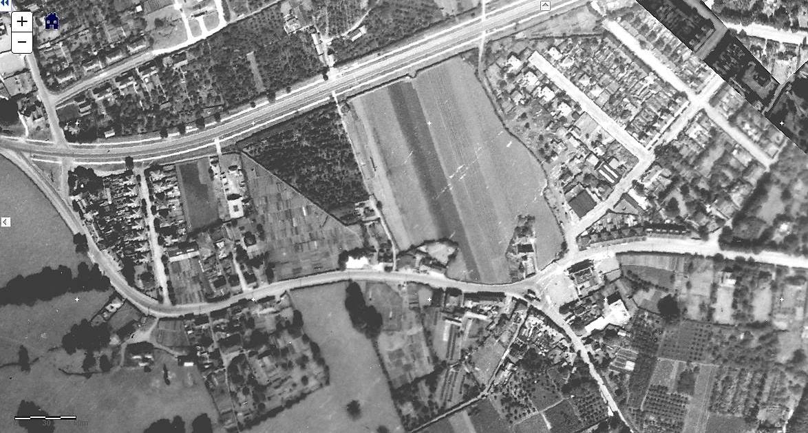
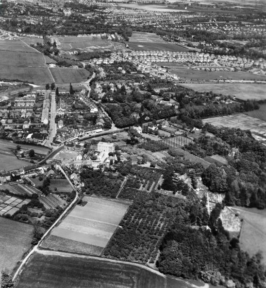
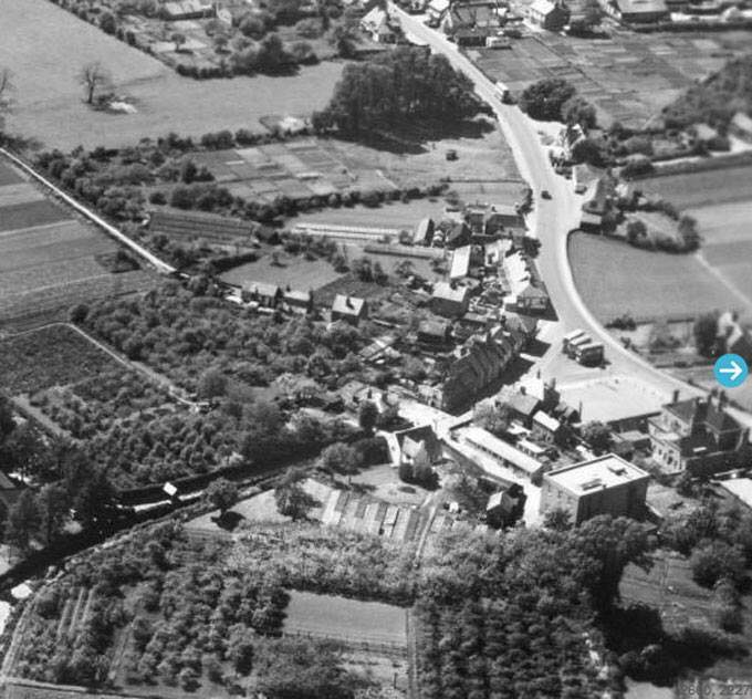
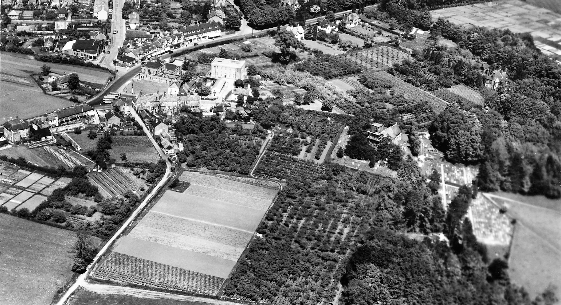
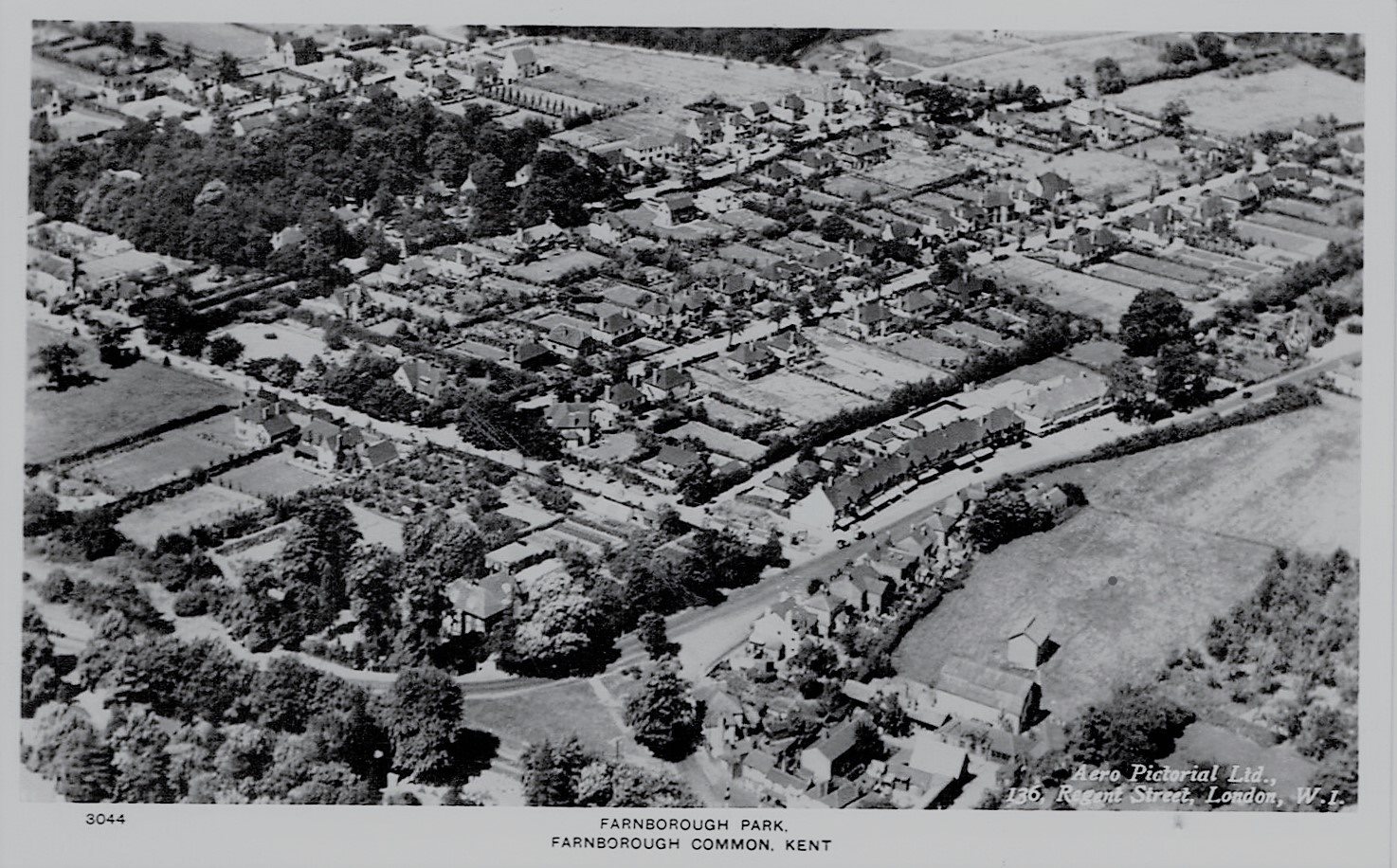
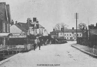
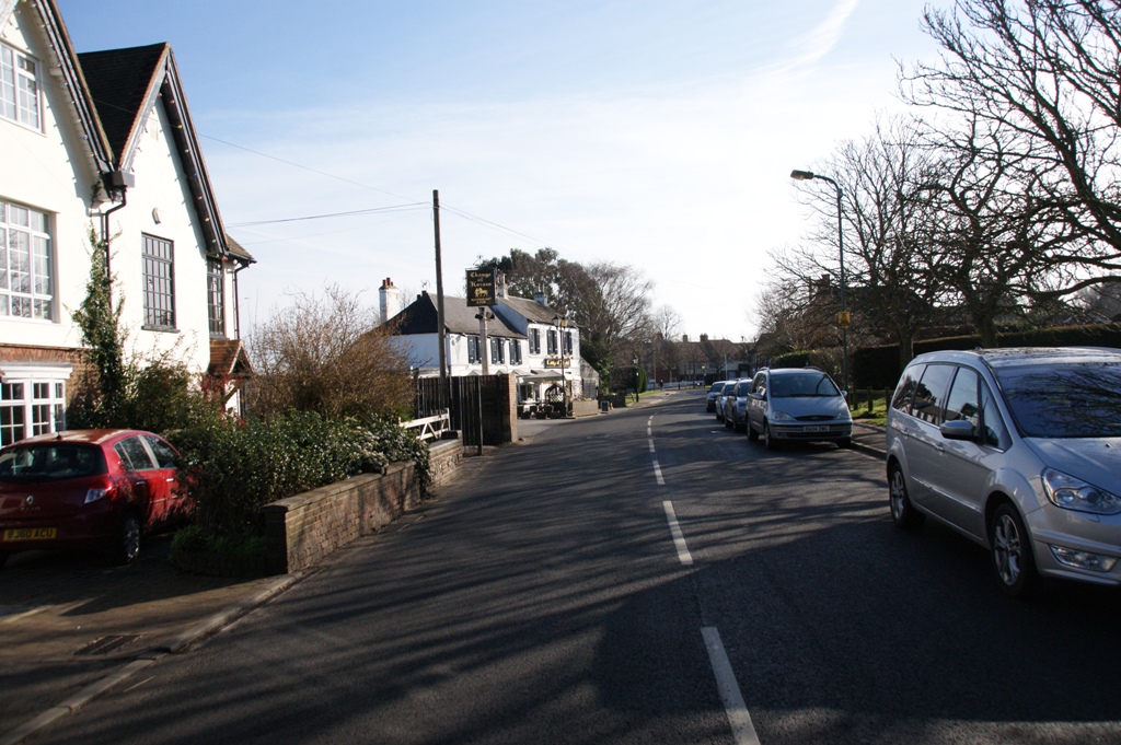
The black and white photographs below were taken 1949-1951, click to enlarge. Contrast these with this modern image taken from Google above.. Click on this to explore with Google street view..
FARNBOROUGH VILLAGE
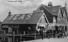
Farnborough High Street
These pairs of photos of Farnborough High Street show that
although there have of course been changes the heart of the
village is still recognisable.High Street
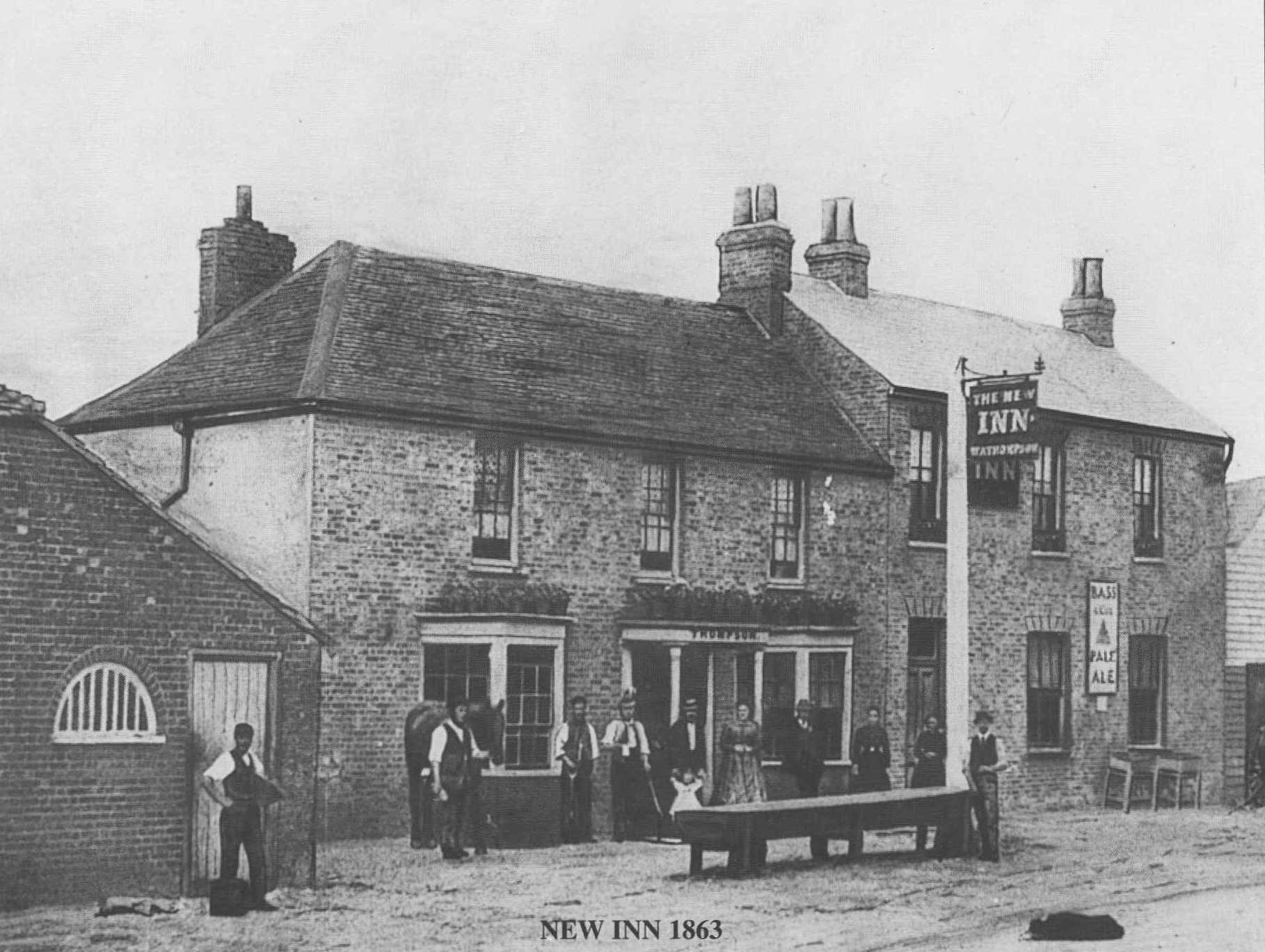
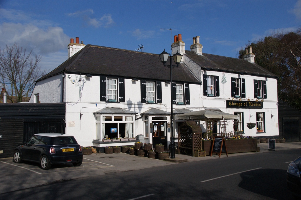
New Inn / Change of Horses
Farnborough Bypass